Agriculture in Tiahuanaco
Tiahuanaco culture developed an amazing, advanced agricultural system while living in a very harsh climate in the Andean altiplano (high plain), at about 12,000 - 13,000 feet above sea level. The area near Tiahuanaco is classified as wet puna, which contrasts with the dry puna environment to the south. The big difference is Lake Titicaca, which provides warmth and humidity in the Tiahuanaco area. They have a dry season and a wet season, with the rains beginning in the spring. Their agricultural system, which you can see in the picture below, is referred to as "raised fields." I've also seen it called "Waru-Waru" and I've seen one source that said the Incas also used this agricultural system, several hundred years after the end of Tiahuanaco culture.
The system is characterized by raised fields separated by canals. The rainwater is channeled into the canals, preventing flooding during the wet season. In the dry season, muck is taken from the canals and applied to the fields as fertilizer. In the picture below, you can kind of see the raised fields, separated by parallel canals in the far righthand side, beyond the area of Tiahuanaco's temples.
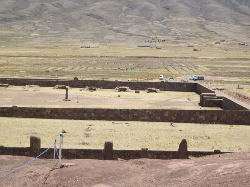
Raised fields
I did not see any of this style of agriculture practiced in Bolivia today, but I found a reference in Miguel Altieri's book (quoted below) about efforts to use raised fields in modern day Peru:
The combination of raised beds and canals has proved to have remarkably sophisticated environmental effects. During droughts, moisture from the canals slowly ascends to the roots by capillary action, and during floods, the furrows drain away excess runoff. Waru-warus also reduce the impact of extremes of temperature. Water in the canals absorbs the sun's heat by day and radiates it back by night, thereby helping protect crops against frost. On the raised beds, night time temperatures can be several degrees higher than in the surrounding region. The system also maintains its own soil fertility. In the canals, silt, sediment, algae, and plant and animal remains decay into a nutrient-rich muck which can be dug out seasonally and added to the raised beds. Soil analysis conducted on samples from reconstructed waru-waru showed increased levels of nitrate nitrogen, phosphorus, and potassium as well as a ph ranging from 4.8-6.5, optimal for potato growth.
From Agroecology: The Science of Sustainable Agriculture by Miguel Altieri, p 171-173.
The crops grown in the Lake Titicaca area at the time of Tiahuanco would have likely been potatoes, quinoa, and some other grains and tubers. I ate one grain called cañawa, and a tuber called oka. Another food eaten in this area is tarwi, a legume grown in a lupine plant. Last, corn reached the Andes from Mesoamerica in the pre-Columbian period and I believe they could have grown it in this region. They would have also had llamas and alpacas during Tiahuanaco times. Today this area is a heavy cow's milk cheese producing region and they also raise a lot of sheep with a few pigs and chickens here and there.
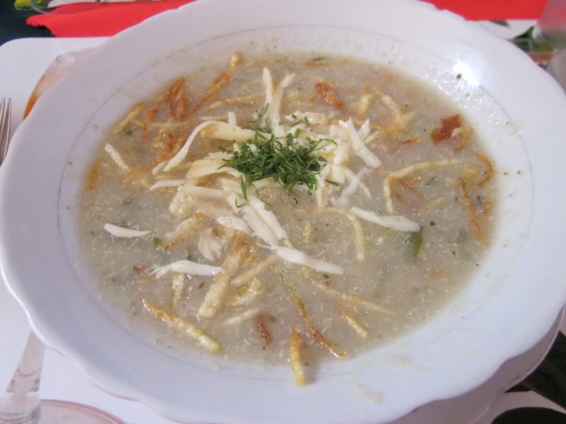
Our lunch: Quinoa Soup with local cheese and fried shreds of potato on top. The main course was your choice of llama or locally-caught trout. I risked all of the mining pollution to try the trout, which was delicious. (Vegetarianism in Bolivia isn't terribly easy unless you consider occasional starvation as an option. I didn't. I also felt it was important to try the locally and sustainably produced food, including non-vegetarian items.)
After lunch, we headed to the Tiahuanaco museum, which was absolutely wonderful. They showed locally grown corn (see the picture below and notice how tiny the ears are!), grains like quinoa and cañawa, tarwi (which I took a picture of), and methods of preserving potatoes, such as chuño, a type of dehydrated potato that is still made and eaten today. Chuño, I've decided, is an acquired taste that is best enjoyed in a soup called chairo where it is cut into little bits and heavily flavored so you can't taste it.
At the beginning, the museum showed a map of Bolivia's topography. You can see the altiplano on the left, bordered by two mountain ranges of the Andes. They also had a fantastic chart that lined up Tiahuanaco and other pre-Columbian civilizations with the civilizations of Eurasia.
Most of the museum showed pottery of the Tiahuanaco culture and other pre-Columbian Andean civilizations. The pottery of the first epochs of Tiahuanaco were quite simple, but they got very complex and ornate (and quite impressive, when compared with the dilapidated stones and broken temples found outside). They showed some early textiles, driving home how advanced Andean cultures have been with textiles for so much of their history. And they showed the pins women used to tie their awayos, the woven clothes used by cholita women to carry their stuff or their babies around (see the picture at the bottom of the cholitas in El Alto). I find it remarkable how far back awayos date and that they are still used extensively today as well. (Today the women use large safety pins to fasten their awayos instead of the pins we saw in the Tiahuanaco museum.)
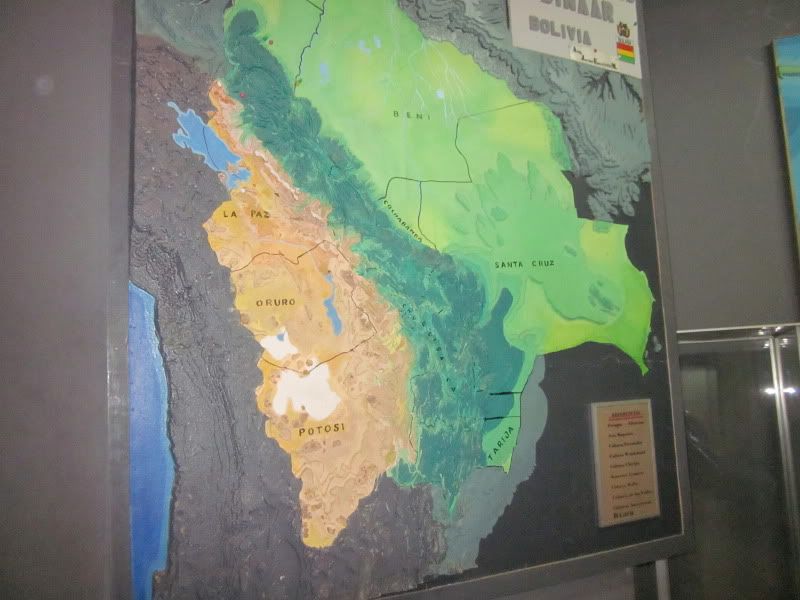
A map of Bolivia, with the top cut off. But the important part of this map is that it shows topography, and the missing part is the department of Pando in the Amazonian lowlands.
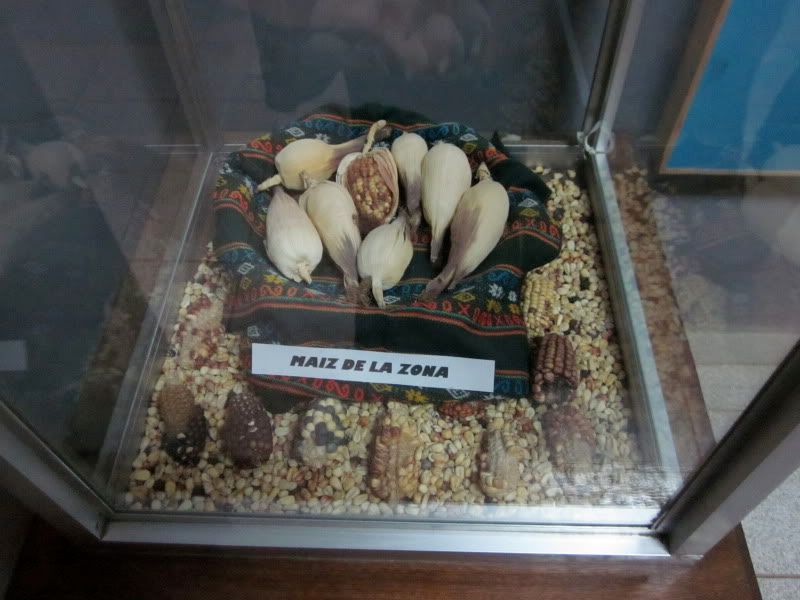
Andean corn
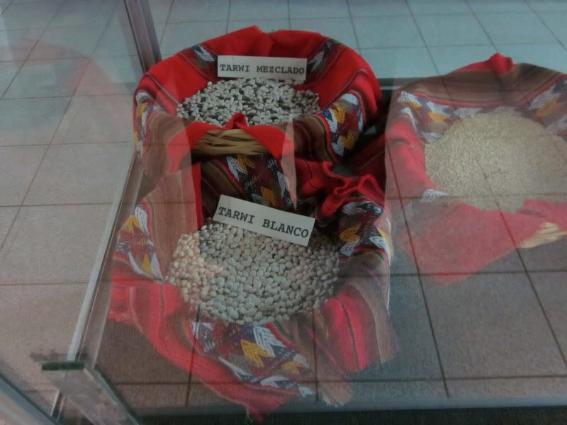
Tarwi, a legume from a lupine plant
After the museum, it was time for shopping. I saw a cholita woman spinning wool into yarn and asked to take a picture. She said only if I buy something. I bought alpaca sweaters for my whole family, and then took the picture shown below. Then we got to talking and found out that we're the same age. What different lives we lead!
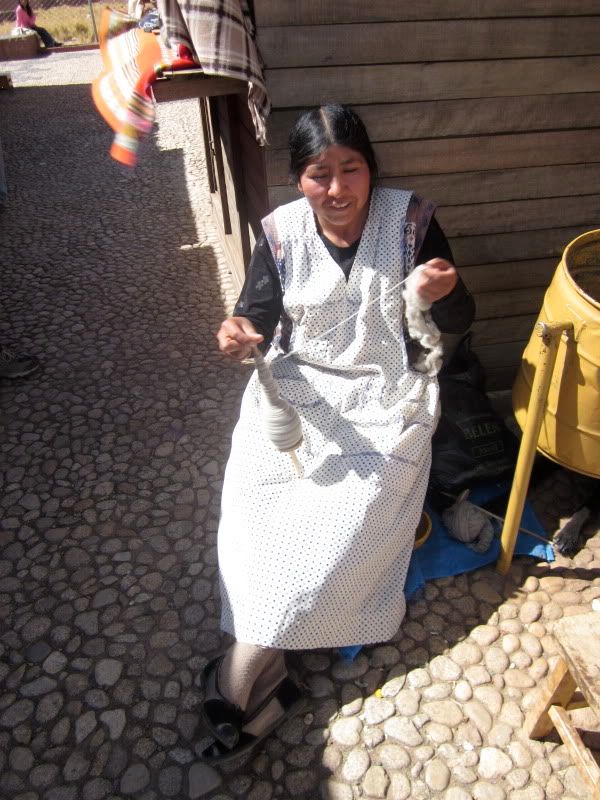
A chola woman spinning wool into yarn by hand
After everyone finished shopping, we got in our minibus and headed back to La Paz, via El Alto (a large city that sits just above La Paz). In El Alto, we happened upon a wonderful festival, which I posted pictures of here. Here's one last picture I took during that drive:
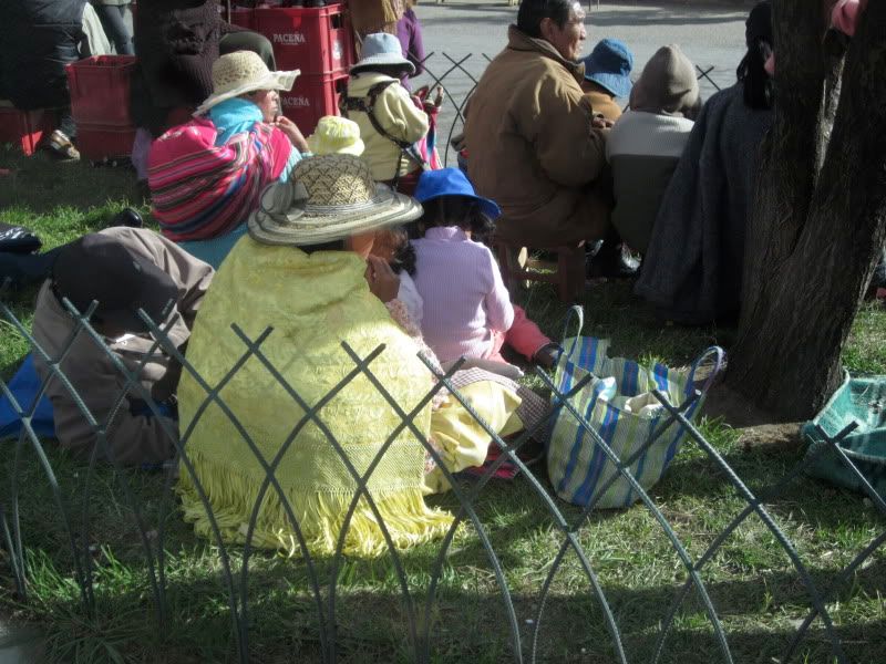
Cholitas watching the festival we passed on the way home in the city of El Alto
No comments:
Post a Comment